
Reality Modelling
What Service We Provide
The process of Reality Modelling relies on the input of Photographic or LIDAR data to produce a scaled digital recreation of the built environment. Our knowledge of Land Surveying, and years of industry experience, allow us to set, and adhere to, specified survey accuracies in line with our clients needs. Applying Reality Modelling techniques, to a once more traditional workflow, can vastly improve collaboration between the client, designers, and engineers whilst also driving down costs.

Reality Modelling Application
During pier extension works at Southend-on-Sea, RCS offered a fast design solution using Reality Capture techniques. Upon removing the timber decking, structural timbers were found to be clashing with the original design. The subject was scanned using a Terrestrial Laser Scanner to produce a point cloud on the site grid reference system.
Next, the original 2D design data was modelled into a 3D CAD file and overlaid with the point cloud data. The position of the new Tie-Rods, Collars and Top Hats were then adjusted and clash detected against the existing structure. Applying this method as an Iterative process found a solution which allowed the new steel work to sit within the existing listed structure.
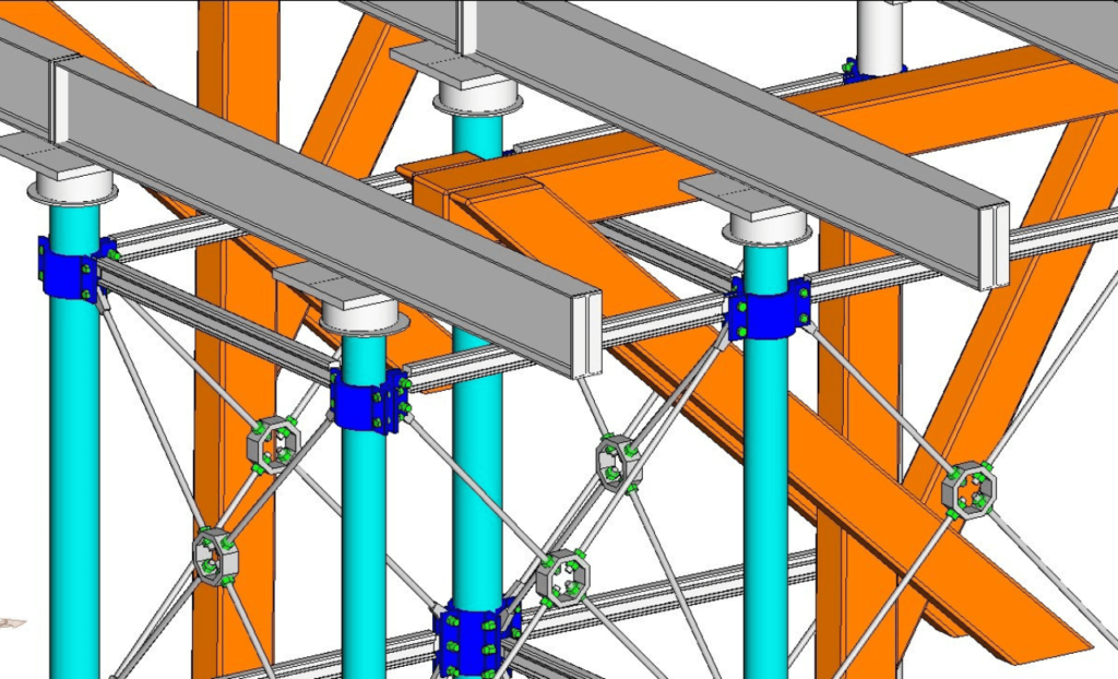
Upon completion of the works, a final scan was conducted of the new pier extension. A 3D CAD model was extracted from the pointcloud data to produce an As-built model accurate to +/- 5mm. The vectorised CAD model was submitted in .DWG format making the data accessible to anyone with basic CAD skills. This deliverable enables the client to interrogate the data at anytime during the lifespan of the pier and can provide details right down to tie rod diameters and bolt sizes.
The Final Step - A Sitewide Georeferenced Reality Model….
Previous
Next
